| data | ||
| examples | ||
| img | ||
| python | ||
| qfits | ||
| scripts | ||
| source-extractor | ||
| src | ||
| .gitignore | ||
| LICENSE | ||
| Makefile | ||
| PORT.md | ||
| README-giza-pure.md | ||
| README-skymap.md | ||
| README-upstream.md | ||
| README.md | ||
| ROADMAP.md | ||
| sextractor | ||
Libre Sattools
Libre Sattools is a free software fork of parts of Cees Bassa's sattools.
Current state: skymap, satmap, and satorbit have been ported to
libre giza. Additional features have been added to skymap.
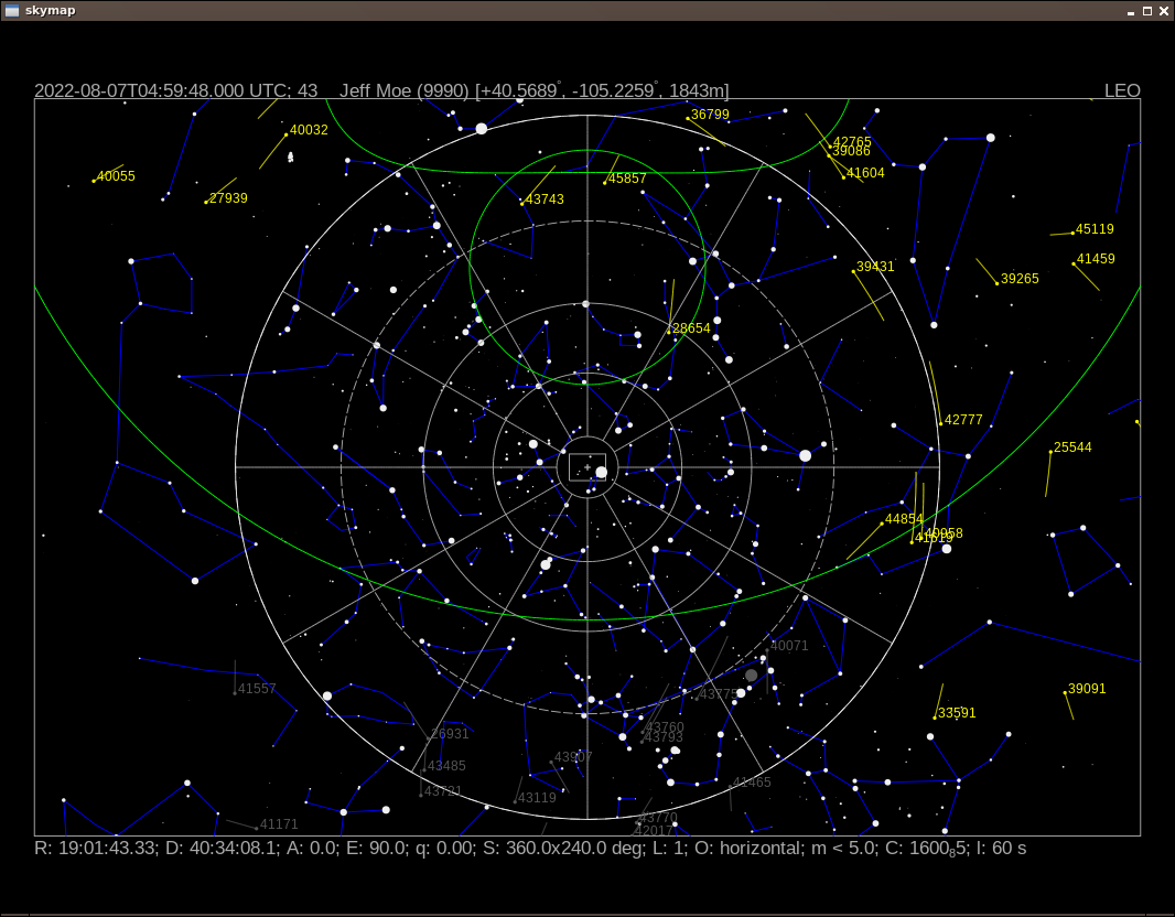
See above screenshot from port of skymap.
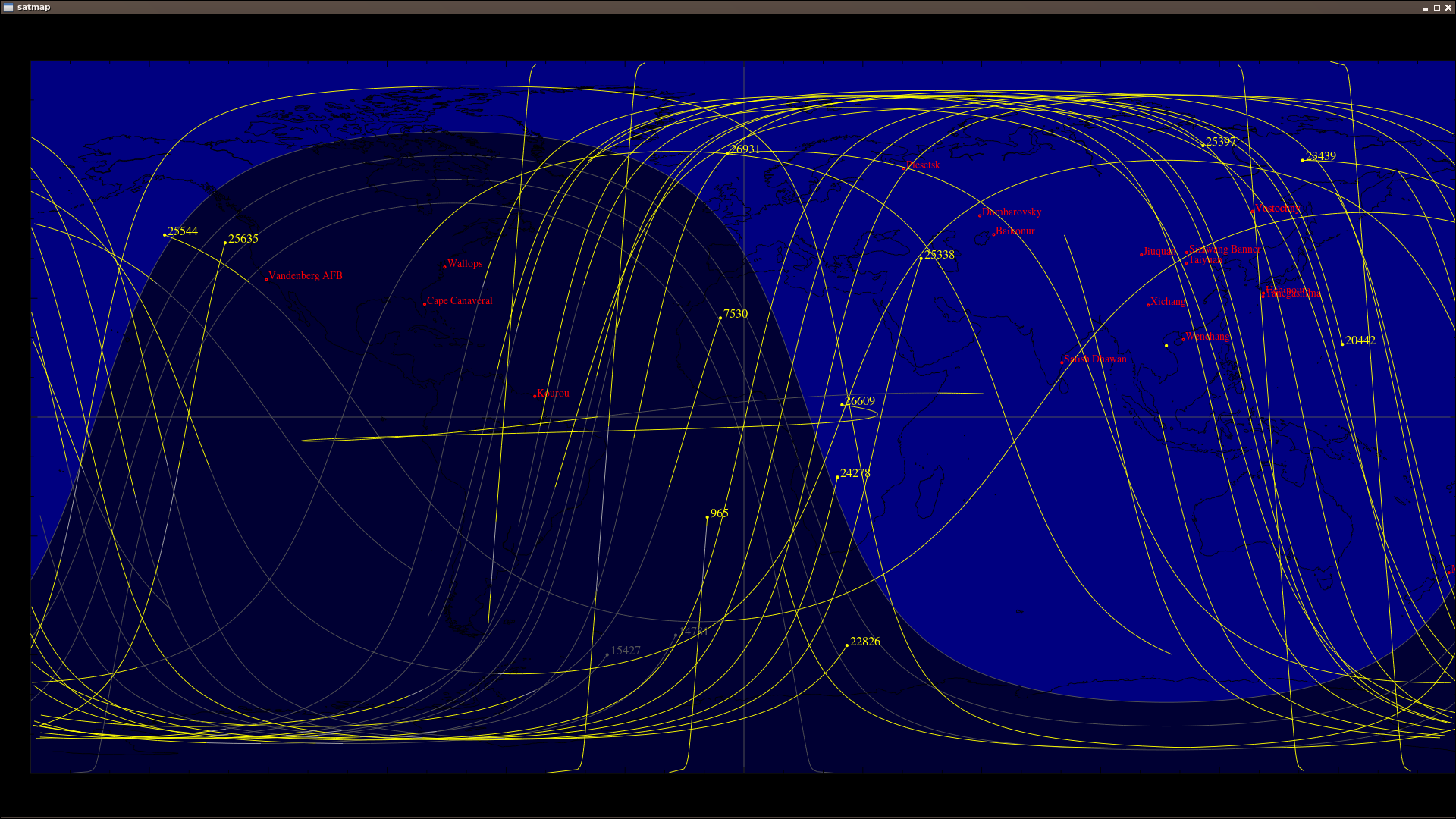
See above screenshot from port of satmap.
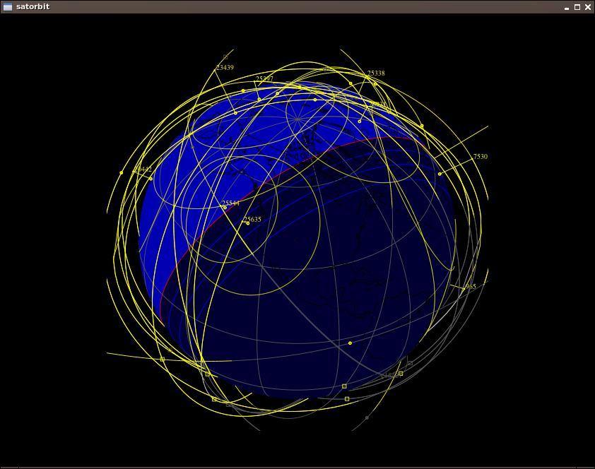
See above screenshot from port of satorbit.
See above screenshot from port of satid.
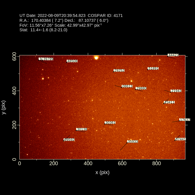
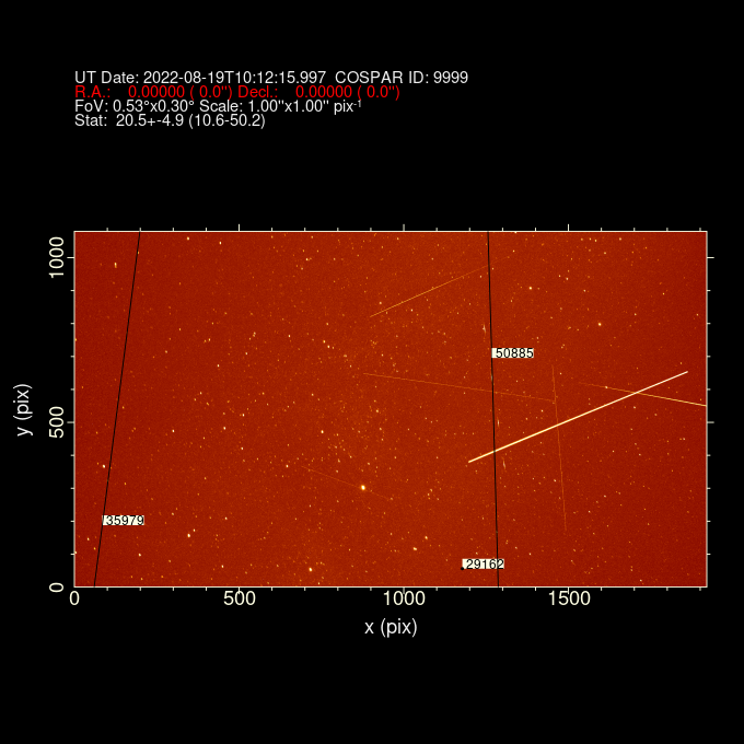
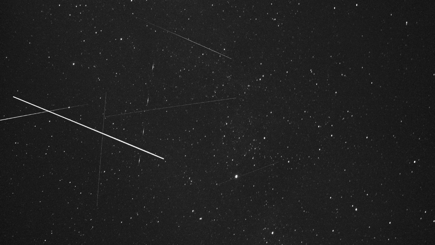 PNG of FITS image from
 stvid, used in example below.
Above, screenshot of this command:
satid examples/satid-sample.fits
mv satid.png examples/satid-sample.png
Note: R.A. and Decl. issue. Values are read from FITS (?).
Features
The giza branch is mostly similar to upstream, but with
giza instead of pgplot.
The following (mis?)-features have been added to skymap in the active
spacecruft branch:
-
Optionally resize window on command line with
--widthand--height. (Probably best to just get width and calculate a good height.) -
Optionally change resolution of drawing lines with
--nmax. (Probably best to calculate nmax depending on window size.) -
Add SatNOGS (now default), last 30 days, Space Stations, Active Satellites, GNSS, and visual TLEs.
-
Update SGP4 files to latest upstream.
-
Add long options (e.g.
--help) on the command line. -
A local version of bits of qfits is included, so no upstream install is required to build. (Are the binary apps needed elsewhere?)
Build
Development is done in Debian Bookworm (testing). Tested and working with Debian Bullseye (11/stable) Doesn't require any dependencies outside of Debian.
sudo apt install giza-dev git make dos2unix source-extractor wcslib-dev \
     libgsl-dev gfortran libpng-dev libx11-dev libjpeg-dev libexif-dev

git clone https://spacecruft.org/spacecruft/sattools

cd sattools/

make

sudo make install

# To clean
make clean

# To rebuild
make clean
make

# To uninstall
sudo make uninstall
Built files get put in the bin/ directory.
Usage
cd bin/
./tleupdate

# set config in ~/.bashrc XXX

./skymap --help
Usage: skymap [OPTION]
Visualize satellites on a map of the sky.

-t, --time    Date/time (yyyy-mm-ddThh:mm:ss.sss) [default: now]
-c, --catalog    TLE catalog file [default: satnogs.tle]
-i, --id    Satellite ID (NORAD) [default: all]
-R, --ra    R.A. [hh:mm:ss.sss]
-D, --decl    Decl. [+dd:mm:ss.ss]
-A, --azimuth    Azimuth (deg)
-E, --elevation    Elevation (deg)
-w, --width    Screen width (default: 1024). Set height too.
-g, --height    Screen height (default: 768). Set width too.
-n, --nmax    nmax line resolution/speed (default 128)
-S, --all-night    All night
-Q, --no-stars    No stars
-a, --all-objects    Show all objects from catalog (default: LEO)
-h, --help    This help
-s, --site    Site (COSPAR)
-d, --iod    IOD observations
-l, --length    Trail length [default: 60s]
-P, --planar-id    planar search satellite ID
-r, --planar-alt    planar search altitude
-V, --visibility-alt    altitude for visibility contours
-p, --positions-file    File with xyz positions
-L, --longitude    manual site longitude (deg)
-B, --latitude    manual site latitude (deg)
-H, --elevation    manual site elevation (m)
Port
Info about the port to free software giza instead of
proprietary and unmaintained pgplot can be seen in the PORT.md file.
Upstream
See README-upstream.md.
Sattools, GPLv3.
Upstream has ported many of the tools to Python. See also:
Giza, GPLv2.
SGP4, LGPLv3:
qfits, libre permissive:
- ftp://ftp.eso.org/pub/qfits
License
Same as upstream sattools, GPLv3.
Copyright (C) 2022, Jeff Moe